Back
Top Areas
Other Areas
- Middlesex
- Grey County
- Muskoka
- Bruce
- Frontenac
- Parry Sound
- Hastings
- Oxford
- Huron
- Lambton
- Northumberland
- Leeds and Grenvi
- Norfolk
- Peterborough
- Nipissing
- Perth
- Renfrew
- Kawartha Lakes
- Haliburton
- Elgin
- Stormont, Dund
- Prescott and R
- Prince Edward
- Lennox & Addin
- Lanark
- Cochrane
- Haldimand
- Chatham-Kent
- Brantford
- Timiskaming
- Brant
- Essex
- Sudbury
- Algoma
- Greater Sudbur
- Manitoulin
- Thunder Bay
- Rainy River
- Kenora
- Leeds & Grenvi
- Haldimand-Norfolk
Sell Your Home

Shortlisted Properties
- New Homes
- For Sale
- For Rent
Danger! Indicates a dangerous or potentially
negative action.

Error
Maximum 4 project can be compared at one go.

Neighborhood Overview
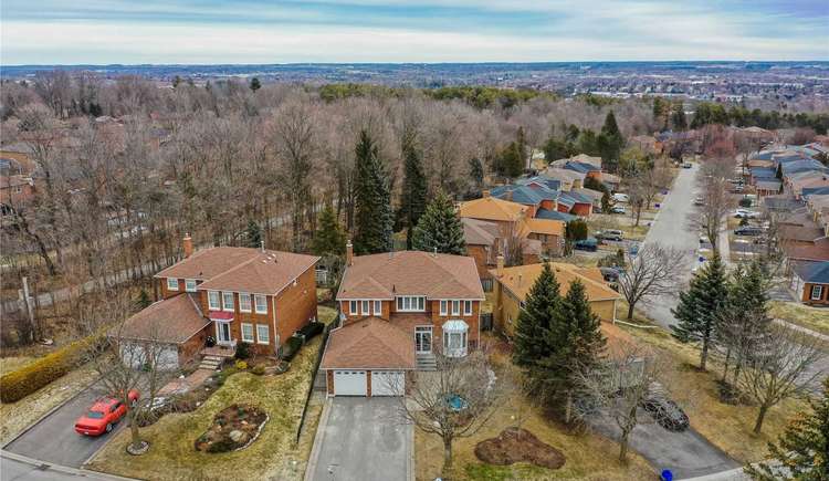
Hills-Of-St-Andrew, York
- Sale : 2936756 - 3900024
- Rent : 3200 - 3200
Last Updated : 18 Days ago

Last Updated : 18 Days ago

Last Updated : 50 Days ago

Last Updated : 51 Days ago

Last Updated : 21 Days ago

Nearby Neighborhoods in Hills of St Andrew
Hills-Of-St-Andrew - Location Map and Landmarks

- Commute
- Education
- Health Care
- Shopping & Recreational
- Nearby Cross Streets
- York Mills Subway, Toronto 1.18 km
- Sheppard-Yonge Subway, Toronto 1.58 km
- Bayview Subway, Toronto 1.77 km
- North York Centre Subway, Toronto 2.23 km
- Bessarion Subway, Toronto 2.46 km
- Oriole Go Station, Toronto 2.96 km
- Leslie Subway, Toronto 3.06 km
- Lawrence Subway, Toronto 3.09 km
- Finch Subway, Toronto 3.41 km
- Wilson Subway, Toronto 4.76 km
- Fairmeadow Centre (Griffin Hyts Program), Toronto 0.21 km
- St Andrew'S Junior High School, Toronto 0.53 km
- Owen Public School, Toronto 0.54 km
- Avondale Alternative Elementary School, Toronto 0.8 km
- Avondale Alternative Secondary School, Toronto 0.8 km
- Avondale Public School, Toronto 0.8 km
- Willowdale Linc, Toronto 1.29 km
- St Edward Catholic Elementary School, Toronto 1.35 km
- Hillcrest Progressive, Toronto 1.35 km
- People'S Christian Academy, Toronto 1.49 km
- North York General, Toronto 3.26 km
- North York General Hospital, Toronto 3.3 km
- Sunnybrook Hosp, Ambulance 57, Toronto 3.81 km
- Sunnybrook Health Sciences Centre, Toronto 3.84 km
- St. John's Rehab, Toronto 3.91 km
- Baycrest Health Sciences, Toronto 4.12 km
- Bloorview Hugh Macmillan Centre, Toronto 4.29 km
- Toronto Rehab - Rumsey Centre Cardiac Rehab, Toronto 4.3 km
- Toronto Rehab Institute - T.R.C. Site, Toronto 4.31 km
- Toronto Rehab Institute - Lyndhurst Site, Toronto 4.32 km
- Metro, Toronto 1.1 km
- York Mills Shopping Centre, Toronto 1.13 km
- Rabba Marche, Toronto 1.14 km
- Whole Foods Market, Toronto 1.41 km
- Food Basics, Toronto 1.44 km
- Yonge Sheppard Centre, Toronto 1.51 km
- Cira'S Gourmet Foods, Toronto 1.54 km
- Subway - Kff Madison, Toronto 1.8 km
- Loblaws Supermarkets Limited, Toronto 1.94 km
- Pusateri'S Fine Foods, Toronto 1.94 km
- Upper Highland Crescent and Tournament Drive, Toronto 0.25 km
- Fenn Avenue and Medalist Road, Toronto 0.41 km
- Lord Seaton Road and Yonge Street, Toronto 0.91 km
- Yonge Street and Lord Seaton Road, Toronto 0.91 km
- Highway 401 Collector and Yonge Street, Toronto 0.92 km
- Bayview Avenue and Fifeshire Road and Fife Road, Toronto 0.92 km
- Yonge Street and Highway 401, Toronto 0.93 km
- Highway 401 and Yonge Street, Toronto 0.94 km


